832 535-8284
Cutting Edge LiDAR and Photogrammetric Technology

SICARIO Aerial Services, LLC
Aerial Drone Mapping Services
LiDAR and Photogrammetric.
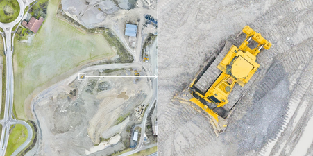
Known for their ability to capture uniquely original data with their lens, clients are always in store for something special when they turn to Sicario Aerial Services, LLC for all their mapping needs. From aerial photogrammetric mapping to survey ready cloud point LiDAR. Specializing in all areas of construction, civil, agriculture, and infrastructure projects.

Services
Sicario Aerial Services, LLC has everything you need to ensure your project is a success. From pre- and post-shoot advice to image and data editing and touch-ups, their range of professional services ensure you’ll receive the perfect outcome. Get in touch to find out more about their services.

Terrain Mapping
State of the art LiDAR equipment. These are a particular specialty of Sicario Aerial Services, LLC, and a must-have if you’re looking to take full advantage of their survey ready cloud point deliverables. If you’re interested in hiring them, please get in touch today.

Civil/Construction
One of the secrets of getting incredible data is having the experience and meticulous approach as easy and stress-free as possible, especially when it comes to Civil and Construction Projects. From as-builts to progress shots. CAD Ready. Get in touch with any questions or special requests.

Agriculture
From tree counts and crop heights to laser precise ground slopes with contours. Sicario Aerial Services, LLC can save you thousands of labor intensive ground work.

Commercial Development
Good photography shouldn’t have to break the bank. That’s why Sicario Aerial Services, LLC offers an accessible rate that matches your needs. Get in touch if you’d like to book this service and experience photography beyond the ordinary.

Volumetric
Quickly and easily calculate the size and quantity of stock piled materials. Remove the guess work and move forward with certainty.

Infrastructure
Efficiently inspect power lines, pipe lines, solar plants, and wind turbines safely and accurately. Identify problems with vegetation clearances and be proactive planned maintenance.

SICARIO Aerial Services, LLC
LiDAR and Photogrammetric Services
Located in Eastern Connecticut providing services for the New England area and the Houston Texas surrounding areas. Remote locations possible by request.
About
Sicario Aerial Services, LLC is an experienced Drone Pilot company who is passionate about Aerial LiDar, photogrammetry, and photography. Sicario Aerial Services, LLC began their venture into Aerial Drone services in 2017 and soon became obsessed with the fundamentals that make a great value added service : timely, accuracy, photogrammetry and survey ready point cloud point deliverables. They offer exceptional personal service for each and every one of their clients, so get in touch today and book your session.
ASPRS Member
FAA Certified
Fully Licensed and Insured

Contact


